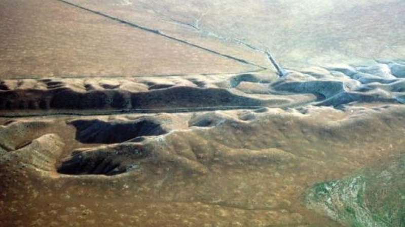
Most people know that California sits on the border of two giant tectonic plates, the Pacific and North American, and they are grinding past each other, which is the reason for so many earthquakes in that area. There are dozens of fault lines separating those two plates, but the San Andreas Fault is most significant. For the first time ever, scientists have been able to produce a computer image with GPS data of the huge sections of California rising and sinking around the San Andreas Fault, and there has been some evidence of vertical movement that is the result of seismic strain that will ultimately released in a large earthquake. Considering that scientists have been wondering for decades if there can possibly be any detectors for "The Big One" that will devastate California like the movie San Andreas, perhaps these recent studies are possible proof.
According to The Seattle Times, scientists have expected that parts of California are rising, and other parts sinking, around the fault in a way that is "ongoing, very subtle, and extremely slow". In fact, a study published in the journal Nature Geoscience on Monday found that much of the Los Angeles Basin, Orange County, Sand Diego County, and the Bakersfield area are sinking 2 to 3 millimeters a year, which is a few widths of a penny annually. In the meantime, parts of Santa Barbara and San Luis Obisop counties, along with a large portion of San Bernardino County, are rising at about the same measurement.
The issue is with those areas closest to the San Andreas Fault, which are locked in place. When the next big earthquake strikes, the different parts of Southern California will be evened out.
In case you are wondering if this is a sign that "the big one" that will be the major quake of California will hit, there is a report on Yahoo News saying that experts don't know when that next wave will hit.
The biggest California earthquake so far was a 7.9 back in 1857 ruptured from Monterey County through Los Angeles County, and then there is a section of the San Andreas between San Bernardino County and Imperial County that hasn't ruptured since 1690. Then there are the most recent in the past 100 years, such as the one that hit San Francisco in 1906, as well as the 6.9 Loma Prieta earthquake in 1989.
The thing is that there is a large rupture for the southern San Andreas that hits once every 150 years, which makes it difficult to predict when the next quake will strike. In fact, it was easy to detect movement along the fault line in a north, south, east, and west direction, but the vertical movement has only been recent development thanks to new technology.
Here's hoping that all these new technology will be able to detect when the next big quake will be coming, so that we can all be prepared for the aftermath.